


Coasts and Changing places.
Cape Cod and Provincetown, USA

The Cape Cod peninsula extends about 100 kilometres from the mainland of southern Massachusetts where it serves as a natural land barrier between Cape Cod Bay and the Atlantic Ocean.
Figure 1. Satellite image of Cape Cod
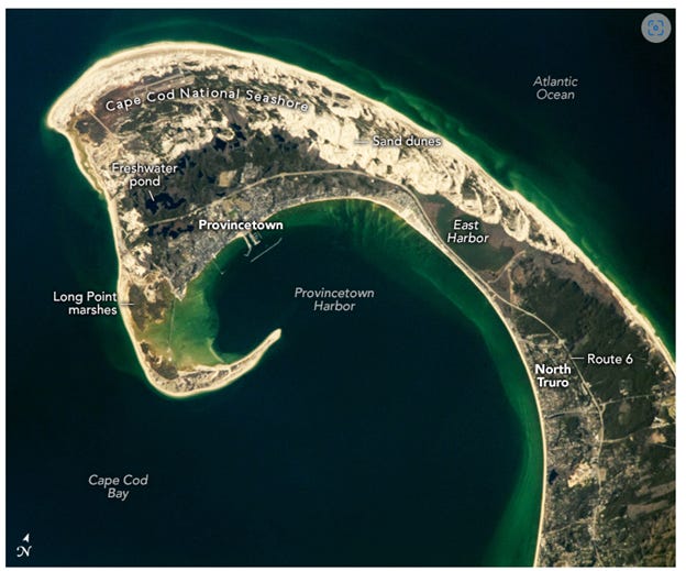
Photo: NASA
Since 1842, ferries in Cape Cod Bay have connected Boston (west of this image) to Provincetown. Ferries and other ships sailing through Provincetown Harbour and around the peninsula’s elongated sandbar used the guidance of Long Point Lighthouse, first lit in 1827.
Cape Cod peninsula’s distinct hook shape started forming 10,000 years ago by glacial erosion and coastal deposition at the time of the Laurentide Ice Sheet. Subsequent natural processes, such as severe storms, waves, wind, and sea level rise have contributed to its shape.
The sand dunes visible in the image started forming after glacial retreat when sediment left by the glaciers was further modified and redeposited by coastal currents and winds. As glacial retreat continued, depressions left in the land surface were filled by groundwater creating freshwater ponds.
Provincetown is a very amenable place, with many restaurants, art galleries and other cultural places to enjoy. It has developed a significant gay community – a UK person could compare the vibes of the town to those of Hebden Bridge, Yorkshire (see an earlier Substack). A central feature is the Pilgrim Monument. This was built between 1907 and 1910 to commemorate the first landfall of the Pilgrims in 1620 and the signing of the Mayflower Compact in Provincetown Harbour. It is a 77m campanile and is the tallest all-granite structure in the US.
The sand dunes, freshwater ponds, and other land features on the Atlantic-facing side of Route 6 form the northern portion of the Cape Cod National Seashore. The 180 square kilometres of the Seashore support a variety of ecosystems, such as the salt marshes at Long Point and the human-made freshwater lake of East Harbor near North Truro.
The variety of ecosystems within the Seashore sustain over 450 species of amphibians, reptiles, fish, birds, and mammals, including 32 species that are rare or endangered. One of those species is the American oystercatcher.
Figure 2. A map of Provincetown dating from the early 20th century
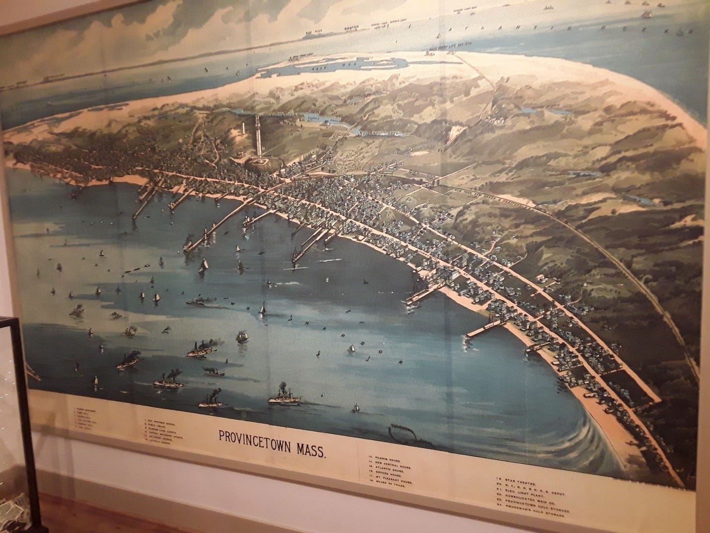
Photo. David Redfern
Figure 3. The view from the Pilgrim Monument looking south
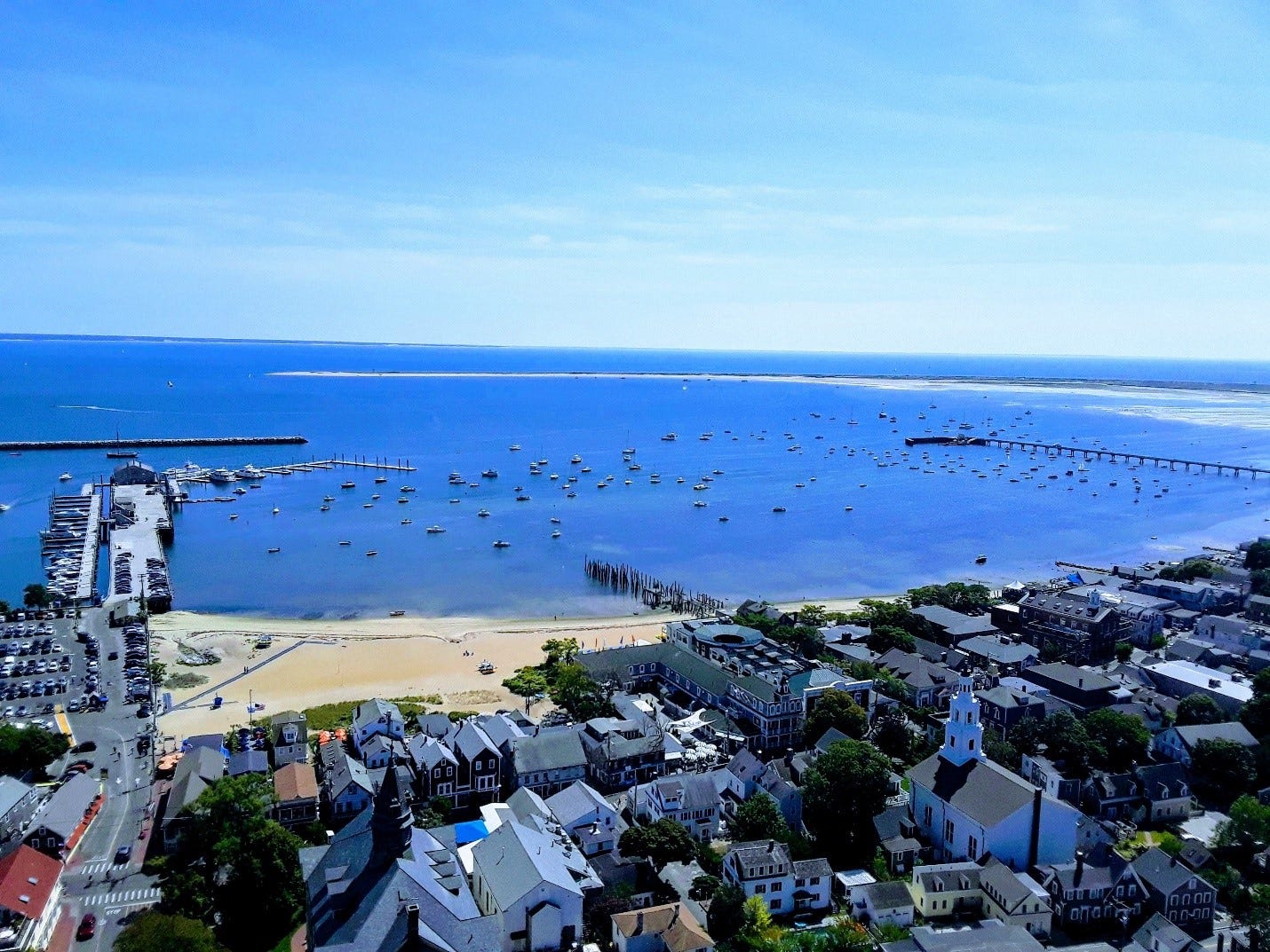
Photo. David Redfern
Figure 3. The view from the Pilgrim Monument looking south-east
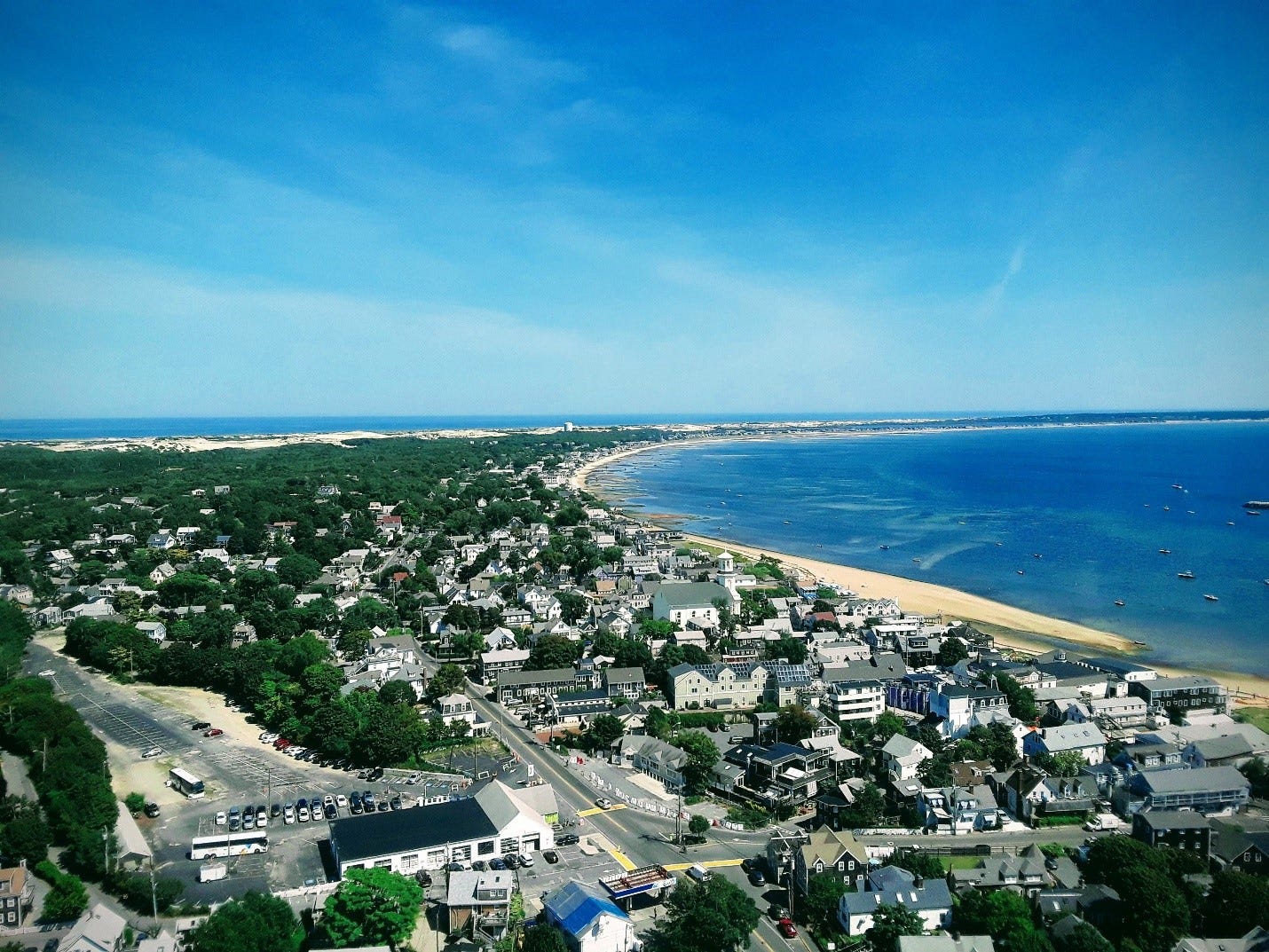
Photo. David Redfern
Figure 3. The view from the Pilgrim Monument looking north-west
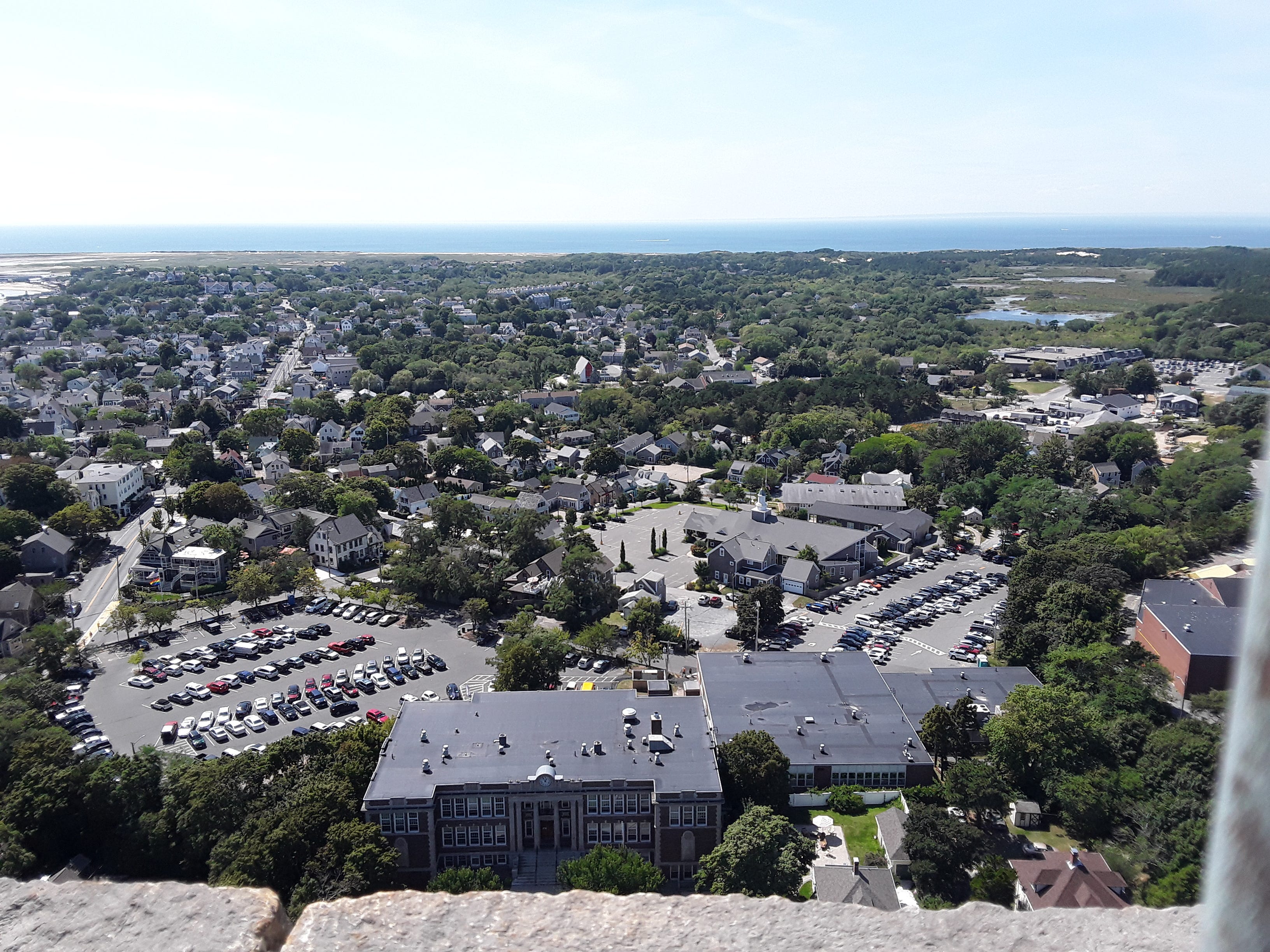
Photo. David Redfern