[Back to the theme of glaciation. I intend to provide posts on the glacial landscapes of each of western Scotland (this one), the Lake District and Snowdonia (Eryri) in the coming weeks.
Welcome to new subscribers - over 3.2k now. I also note that more are using the Substack app, which is good. You will find it particularly useful for a forthcoming post - not related to glaciation - where some superb photos of one distinctive area of London will feature.]
Rock basins and ribbon lakes
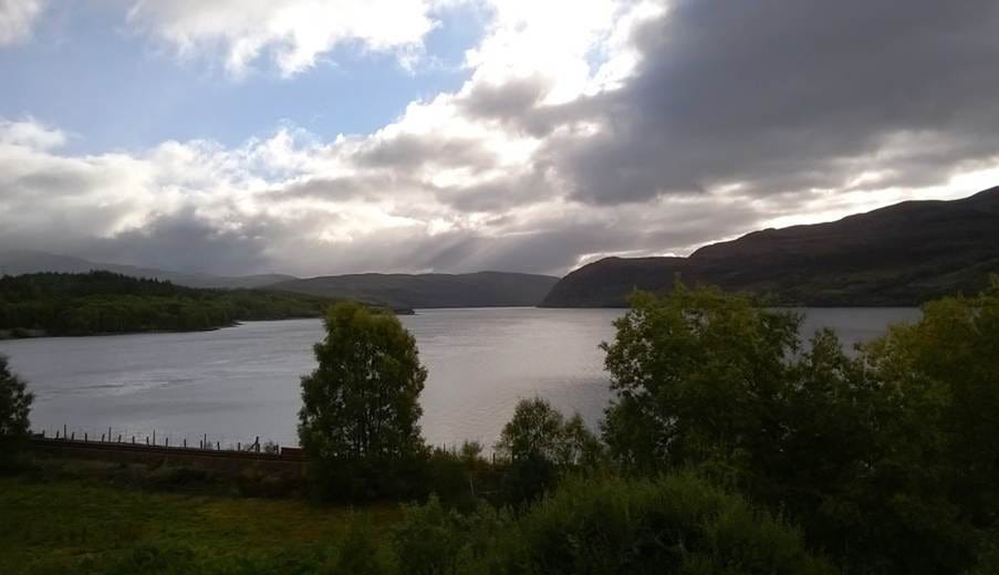
The erosive power of successive glaciers in the Western Highlands of Scotland is illustrated by their ability to gouge out deep bedrock basins in the floors of glacial troughs (see photos of the Cairngorms in the previous post). These are now frequently occupied by long, narrow inland lochs, called ribbon lakes. Some are very deep: Loch Morar is at a depth of 310 m, Loch Ness 230 m and Loch Lomond 90 m. It is thought that Loch Ness alone contains over 7km3 of water.
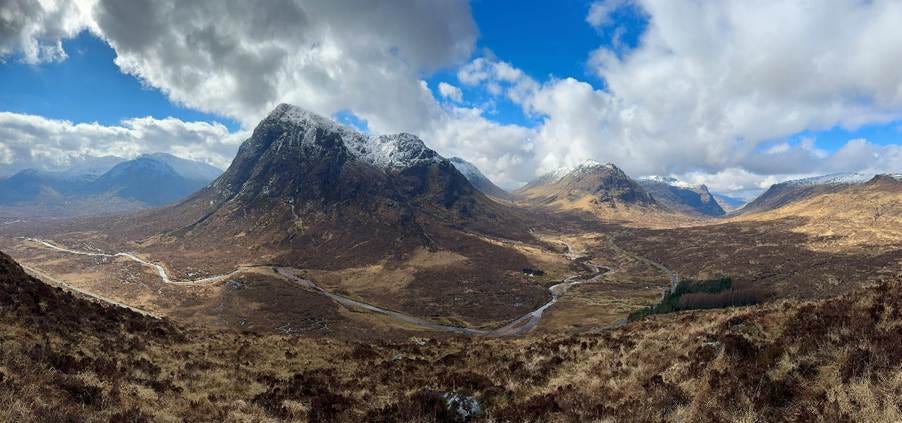
The valley of Glencoe typifies the glacial landscape of the western Highlands – see Photo 1, taken by Sophie Carr.
Photo 1. Glencoe
Photo: Sophie Carr
Several of these rock basins follow major fault lines, where successive glaciers and ice sheets have excavated the fractured rock along the fault. Others were formed where glacial troughs narrow, causing ice flow to accelerate and erode deep into the underlying bedrock. Most, however, were excavated where the confluence of two or more glaciers forced ice flow to accelerate and erode the underlying bedrock.
The fjords that are a feature of the western seaboard of the Western Highlands are drowned glacial troughs that were flooded when eustatic sea level rose due to melting of the ice sheets after the last glacial stage and during the Early Holocene. Typically, most consist of deep rock basins that shallow near their outlets where glacier flow was less constricted – a submarine feature known as a threshold.
Photo 2. Loch Luichart – an inland ribbon lake
Photo: Michael Redfern
Corries
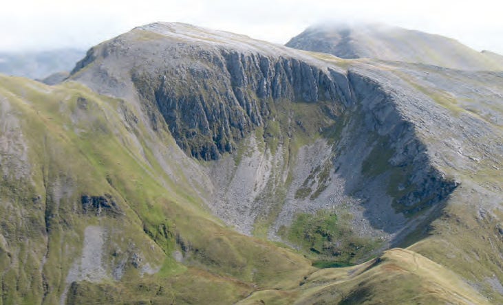
Glaciers in the mountains were fed by numerous corries, large circular bedrock hollows. with steep backwalls and sidewalls. Some enclose a shallow basin containing a small lake, known in Scotland as a lochan (Photo 3). Most corries are 200–1,200 m wide, though compound corries which formed through the merging of adjacent lakes are larger. The majority occupy north- or east-facing slopes where persistent snow cover accumulated to form corrie glaciers during the early stages of each glacial stage. The altitude of corrie floors rises eastwards across the Highlands, from 100–400 m to 500–900 m.
Although corries form primarily through subglacial erosion, they are widened by rockfall during inter-glacial stages. The rock-walls of some corries and the flanks of some glacial troughs form sharp-crested ridges (arêtes). Although these are sometimes attributed exclusively to glacial erosion, most Scottish arêtes were formed by major rockslides during interglacial periods, with the rockslide debris being removed by glaciers during subsequent glacial stages.
Photo 3. A corrie in the Grampians
Moraines
Much of the Highland zone was re-occupied by glaciers during the cold Loch Lomond Stadial. The limits of these final glaciers are defined by end and lateral moraines or by the distribution of recessional moraines, which represent deposition of sediment at locations where glacier retreat was interrupted by short-lived advances of the ice margin.
Such evidence has enabled reconstruction of the extent of the Loch Lomond Re-advance glaciers, their pattern of retreat, and the climate of the Loch Lomond Stadial when the glaciers reached their maximum extent.
Barren landscapes from areal scouring
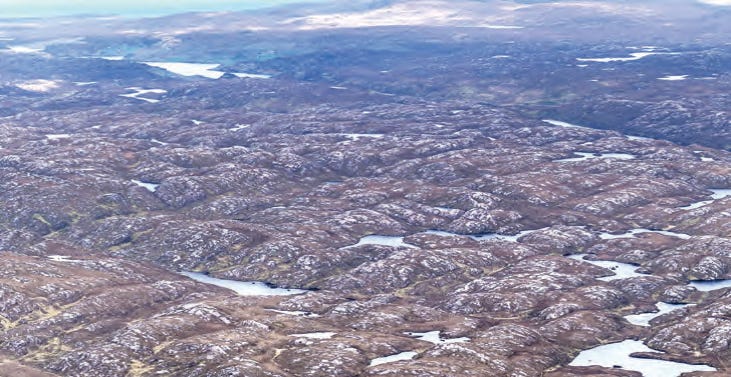
In low-lying areas of the Western Highlands that are underlain by resistant rocks, erosion by successive ice sheets has produced a landscape of rocky knolls separated by small lochs and peat-filled hollows. Taking their name from the Gaelic words cnoc (small hill) and lochain (small loch), such landscapes are known as knock-and-lochan (Photo 4).
The most extensive examples of knock-and-lochan terrain are located on low ground underlain by gneiss rocks along the north-west coastline. They have formed where subglacial erosion has excavated zones of weathered rock, leaving the intervening areas of more resilient bedrock as whalebacks (low hills of rock that that are glacially abraded on all sides) and roches moutonnées. The latter are partly rounded bedrock outcrops, abraded and striated on the up-glacier side but with a steep face created by glacial plucking and detachment of rock on the down-glacier side. In such landscapes moraines are usually absent.
Photo 4. Knock and Lochan landscape of Assynt
The Eastern Highlands
As stated in the previous post, large areas of pre-glacial undulating plateaux survive in the eastern Highlands. Though these are dissected by some deep glacial troughs with some few cirques at their margins, rock basins, ribbon lakes and glacial breaches are much rarer than in the western zone, and mountain ridges and arêtes are absent. In these areas, ice accumulating on plateau areas remained cold-based (see previous post for an explanation of this term) throughout entire glacial stages, preserving much of the pre-glacial plateau landscape. As thicker ice formed in the limited number of corries, the base of the ice reached pressure-melting point, becoming warm-based and eroding the pre-glacial valleys to form some glacial troughs. Here, most troughs terminate up-valley at steep, rocky trough heads that mark the locations of where the slow-moving, cold-based ice on plateaux thickened to become warm-based and erosive.
The corries and troughs of the eastern Highlands also contain end, lateral and recessional moraines deposited by glaciers during the Loch Lomond Stadial, but most of these glaciers were much smaller than those in the west because of very limited snowfall in areas east of the western icefield. Many extended no farther that the lips of cirques, or only a few kilometres down-valley from their sources.


