


Low Traffic Neighbourhoods (LTNs) and 15-minute cities
An aspect of Changing places

[A slightly longer than usual post today, but I hope you find it useful - a topical update perhaps to Changing places and Urban Futures. I have a post on Population Futures coming soon.
Welcome to new subscribers (I’m particularly pleased to find someone from an Austrian university). If you are an A level Geography student in the UK, and your exams are imminent, then I suggest you investigate the archive where there are several posts on essay writing and exam technique.]
Introduction
In March 2024, an official study on Low Traffic Neighbourhoods (LTNs) in England, commissioned by Prime Minister Rishi Sunak, concluded that LTNs are generally popular with the public and effective. This must have come as a disappointment to Mr Sunak as he had ordered the report to capitalise on his promise to be ‘on the side of drivers’ following the Uxbridge by-election where opposition to London’s Ultra Low Emissions Zone (ULEZ) had been a major factor. It is notable that the report has not yet been published, though the Guardian newspaper has seen a leaked copy.
The authors of the report carried out surveys work in four areas – London, Birmingham, Wigan, and York. They found that twice as many local people supported (45%) LTNs as opposed them (21%). In terms of their effectiveness, the report states ‘the available evidence …. indicates that LTNs are effective in achieving outcomes of reducing traffic volumes within their zones while adverse impacts on boundary roads appear to be limited’. Worryingly perhaps, 58% of people did not even know they lived in an LTN.
The report is a blow to the PM in his attempt to attract potential voters by blocking schemes that encourage ‘active travel’, such as promising a clampdown on LTNs, bus lanes and 20mph speed limits in residential areas. As part of this policy, it is understood that the DfT plans to launch a consultation on denying councils access to centrally held data from automatic number-plate recognition cameras if it is felt that they are enforcing road rules too vigorously. It is thought that this ‘plan for drivers’ was guided in part by government worries about so-called 15-minute cities, an urban planning concept that has become the focus of right-wing political concerns around the world.
LTNs
LTNs are a common traffic management tool used for decades that stops motor vehicles from using smaller, residential streets as cut-throughs, using camera-enforced signs or physical barriers but allowing full access for pedestrians and bicycles. They became controversial after a large number were installed, many in London, during the Covid-19 lockdowns, to help people travel around more safely and easily on bike or foot.
Although there have been some initial problems, for example with emergency services, this tended to be when schemes had been rushed through or were new, and the issues tended to ease over time. While the Metropolitan Police and one ambulance service reported initial problems, overall ‘LTNs do not adversely affect response times for emergency vehicles’, the report states.
Critics of LTNs argue that they benefit people living inside them largely by pushing traffic on to nearby roads. However, the DfT report states this did not seem to be the case, despite perceptions. ‘There appears to be limited evidence of adverse impacts on boundary roads, but residents are more likely than not to think that schemes have added traffic congestion and queues to these nearby roads.’
The report found some evidence of the schemes encouraging people to walk and cycle, as well as interim findings that LTNs tended to lead to a reduction in road danger and street crime, while saying more research was needed. It noted mixed findings among people with disabilities.
‘Liveable neighbourhoods’ and the 15-minute city
According to Bristol City Council, an LTN is a low-traffic initiative intended to provide ‘an opportunity to work with local communities to co-design residential streets that are better balanced for all road users, including pedestrians and cyclists’. The Council states that this will create a liveable neighbourhood.
The 15-minute city is a concept of urban planning that emphasises the importance of creating neighbourhoods where people can meet most of their daily needs within a 15-minute walk or bicycle ride from their homes. The concept was devised by the Paris-based urbanist and professor at the Sorbonne Carlos Moreno and put into practice in a major way by the Paris mayor Anne Hidalgo. She promised that she would close off some roads and turn them into public plazas and plant more trees. Such a city aims to reduce reliance on cars and increase the use of public transport, walking and cycling. It encourages the development of mixed-use neighbourhoods with a range of housing types, shops and services and public spaces near each other. The idea is to create a more sustainable, liveable, and resilient city. It also promotes environmental sustainability by reducing carbon emissions and preserving green spaces and local biodiversity.
Arguments used against LTNs have included:
· Families with children at different schools experience access issues.
· Elderly people being unable to access care.
· Harm to local businesses which may have delivery difficulties and customer access.
· Worries over access of emergency vehicles.
Several city authorities around the world have adopted a 20-minute threshold. They include the Portland (USA), Glasgow (Scotland) and Hamilton (New Zealand). Ambitiously perhaps, Copenhagen launched an ambitious ‘5 minutes to everything’ model in 2016. In some cities where no specific x-minute pledge yet exists, planners are giving greater priority to walkers and cyclists alongside other neighbourhood sustainability initiatives. Examples include Amsterdam, Barcelona, Cardiff, Milan, Shanghai, and Melbourne. (Figure 1)
Figure 1. Melbourne’s 20-minute city

Objections.
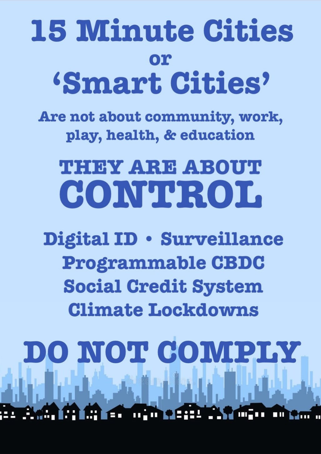
Not everyone agrees with the principle of 15-minute cities. In Oxford, UK, a recent proposal by the Council met opposition where the poster in Figure 2 appeared. Much of the opposition originates from a plethora of right-wing political groups, known as libertarians and ‘real’ or ‘new’ conservatives.
One example of this took place in the UK Parliament when the Conservative MP for Don Valley, Nick Fletcher, launched a tirade against the concept. He said ‘Will the Leader of the House please set aside time for a debate on the international socialist concept of so-called 15-minute cities and 20-minute neighbourhoods. Sheffield is already on this journey, and I do not want Doncaster, which also has a Labour-run socialist council, to do the same.’
[I must inform the reader that I live in Doncaster (though thankfully not within the Don Valley constituency), on a 20mph street – though my current bugbear is the number of people who fail to abide within this speed limit.]
A correspondent on the TV channel GB News stated: ‘Creepy local authority bureaucrats would like to see your entire existence boiled down to the duration of a quarter of an hour’. He also referred to the 15-minute city being a ‘dystopian plan’ heralding ‘a surveillance culture that would make Pyongyang envious’.
Figure 2
A European example – Eixample, Barcelona
The Eixample is a district of Barcelona on the outskirts of the old city which was largely constructed in the 19th and early 20th centuries. The area is designed as a series of square residential blocks with long straight streets crossed by wide avenues. A key characteristic is the bevel edge of the blocks at road junctions (called chamfered). They were designed by Ildefons Cerda who considered that light and ventilation were as important as providing ease of access for transport. Today they provide ideal places to park cars, and provide recycling bins, off the main roads.
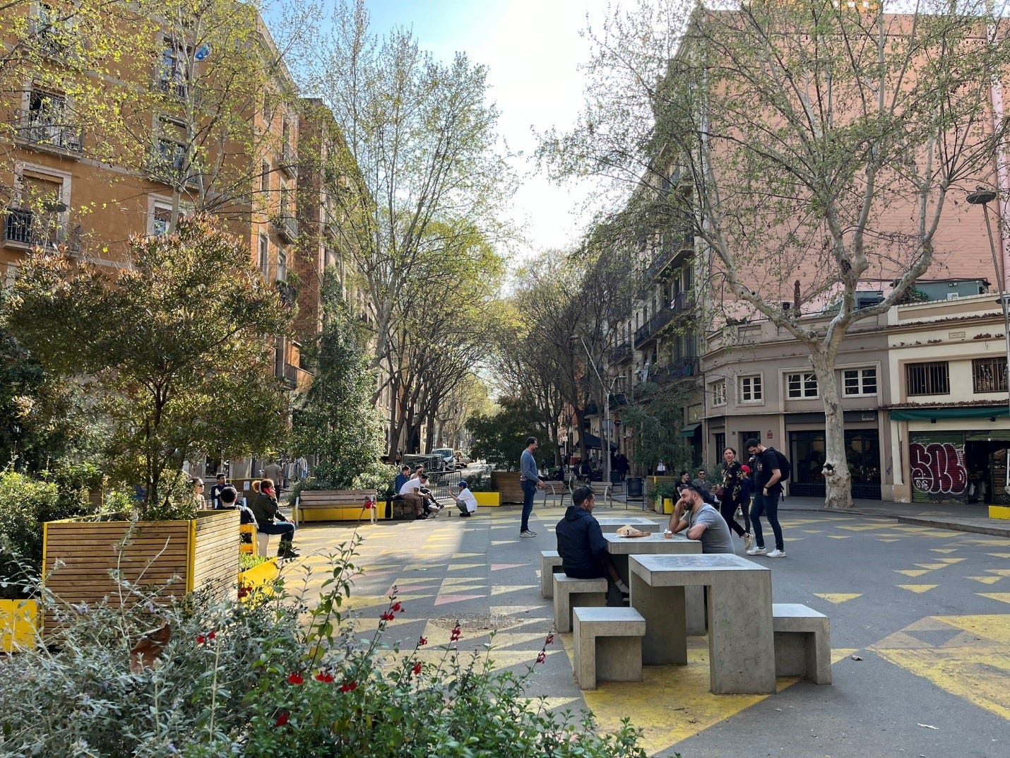
There are plans to convert parts of this area into LTNs. There are aims to have large spaces for local people, with meeting areas, room for children's games, and street furniture, with more greenery.
Photo 1. A typical Eixample chamfered square
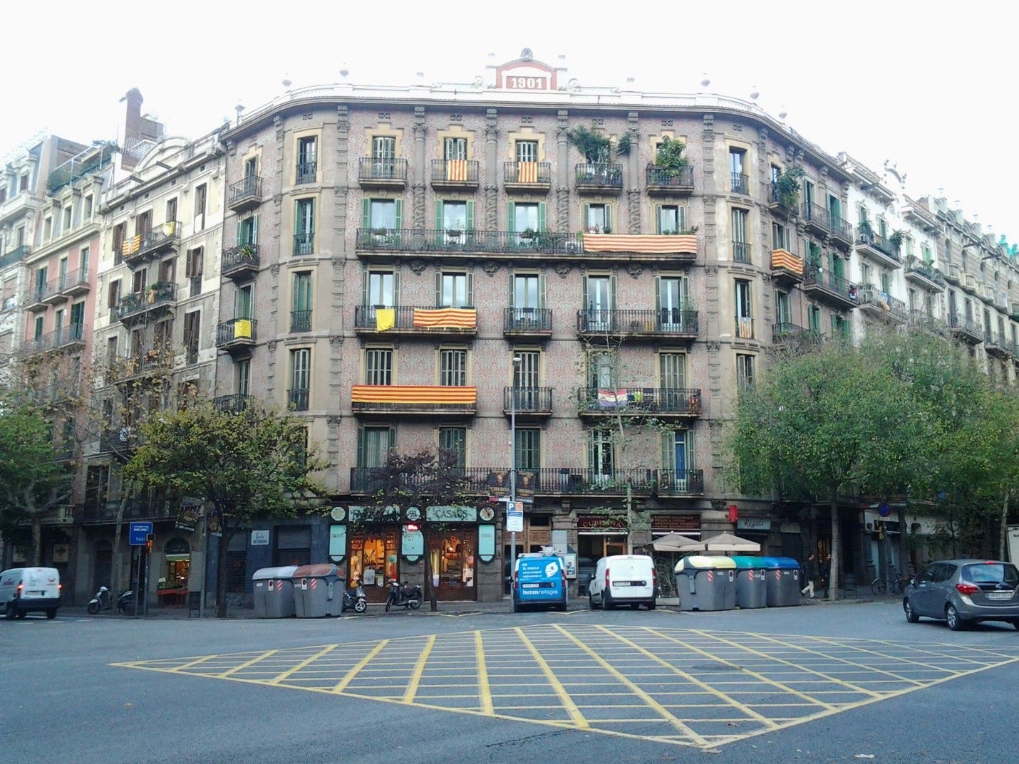
Photo: David Redfern
What will the new areas be like?
Different levels between road surfaces and pavements will be eliminated, with kerb-less paving to help foster social use of these streets.
Pedestrians will have priority. Cars may only circulate at 10 km/h.
Asphalt will disappear and will be replaced with the city’s typical panot paving blocks and granite along the length of all these axes.
Greenery currently accounts for 1% of space in these streets, a figure set to rise to 14% on average.
The project will also see over 400 new trees planted.
Nearly 1,000 new items of furniture (benches and seats) with new lighting.
Loading and unloading will be permitted during specific times.
Photo 2. An LTN square in Eixample (imagined)
Conclusion
The 15-minute urban concept has value given that its main goals include improved individual wellbeing, community cohesion, and lower carbon emissions and air pollution. Clearly, there are practical problems to be worked out when it comes to applying the idea. For example, which services and amenities are sufficiently ‘essential’ that they should be readily available in every neighbourhood? People also require access to high-order services, such as specialised hospital treatment or a high-level sports match, which can only be provided in a limited number of locations for obvious reasons of cost. How do areas of employment fit into the plans?
We must also be mindful of social diversity. People walk or cycle at different speeds or may be unable to do either of these easily. Perhaps the 15-minute idea relies too heavily on an underlying assumption that everyone is healthy, and willing to navigate urban space on foot or on a bicycle?
These misgivings aside, the 15-minute concept is attractive. When employed as a placemaking strategy, it has a proven track record of creating media headlines, both positive and negative, and focusing public attention on the need for more sustainable urban futures.
One of the big lessons for geographers from LTNs is that people don't like change to their place when it feels imposed from outside. (This isn't just about places, we are generally fearful of any change we don't control).. It is about the way changes are made rather than the nature of change.
My road has some barriers at the end that must be 20-30+ years old. I know that makes our neighborhood an LTN because I am a geek. Most of my neighbours don't. If the Council removed them one day there would be fury. It is not the nature of the change but the control you don't have over it.