


Satellite stories 4
Cairo – a new capital

[It is two weeks since the last post, during which I have been on holiday, and over 200 new subscribers have joined. The total is now over 2,600. Welcome to all. Where have I been? Here is a clue…, which may be useful to students of the various World Cities/Urban geography options on current A Level Geography courses.]
Many of the cities along the shores of the River Nile in Egypt are having new versions of themselves built in the desert about 20km from the original city alongside the river. They are purpose-built with new road layouts, new industrial areas and with all the needs of the populations moving there. All these new towns just have the prefix ‘New’ before the original name. Examples include New (El) Minya, and New Sohag… and New Cairo.
Cairo is one of Africa’s largest cities which has undergone major expansion for several decades. Its population has grown from about 8 million in 1984 to over 23 million today, and this near tripling of the population has dramatically changed the city’s urban footprint. The city has a population density of more than 19,000 people per square km. The central part of the city is chaotic in a number of ways – traffic moves around in a manner that defies logic (and safety), vaguely sticking to a driving on the right system; the roads themselves quickly change from tarmac to basic rock foundations; housing is multi-rise, but the majority are unfinished, with just bare brick between concrete supports, and with steel wires sticking up awaiting the next tier to be added.
In addition to building upward and outward along the fertile floodplain of the Nile River, development has spread to several new satellite cities built on desert plains outside of the city, one of which is called New Cairo City.
The city’s period as Egypt’s capital is also coming to an end. The country’s seat of the national government is moving to a brand-new city in the desert 45km east of Cairo. In response to Cairo’s rising population, congestion, and pollution, the government announced in 2015 that it would build and migrate to the so-called New Administrative Capital (the city is not yet officially named). The new city will ultimately cover an area about the size of Singapore. It is designed to house more than six million residents, along with Egyptian government offices, a financial district, and other facilities. By March 2024, more than 1,500 families had already moved to the city, with that number expected to reach 10,000 by the end of the year. Government ministries are relocating, the parliament began meeting in its new building, and several banks and businesses were scheduled to move their headquarters there.
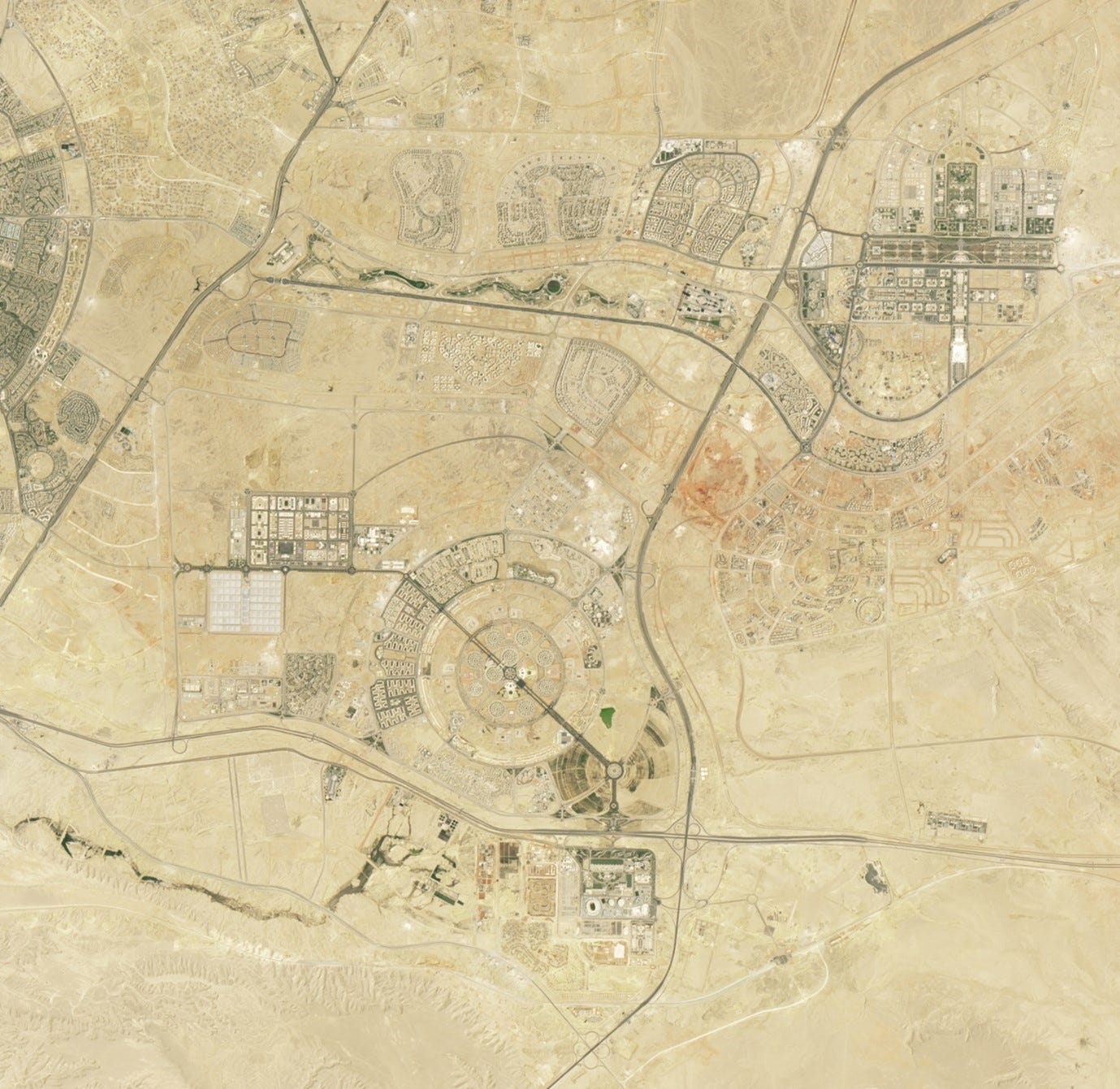
These images of the new capital were taken in August 2017 and August 2024 (Figures 1 and 2). In the earlier image, traces of the new city are visible; work on the megaproject had begun by this time. The expansion of the New Administrative Capital is evident in the later image. Several large landmarks in the new capital are visible in the images. Winding green space, part of Green River Park, stretches for 10km through the arid landscape, containing walking and biking paths and native Egyptian vegetation. Many government ministry offices comprise the dense development to the east of the park, while the Ministry of Defence occupies a sizeable facility called The Octagon (despite its concentric-circle appearance in the image). To the south, a sports complex contains the second largest stadium in Africa and many other sports facilities.
Figure 1: Area east of Cairo - 2017
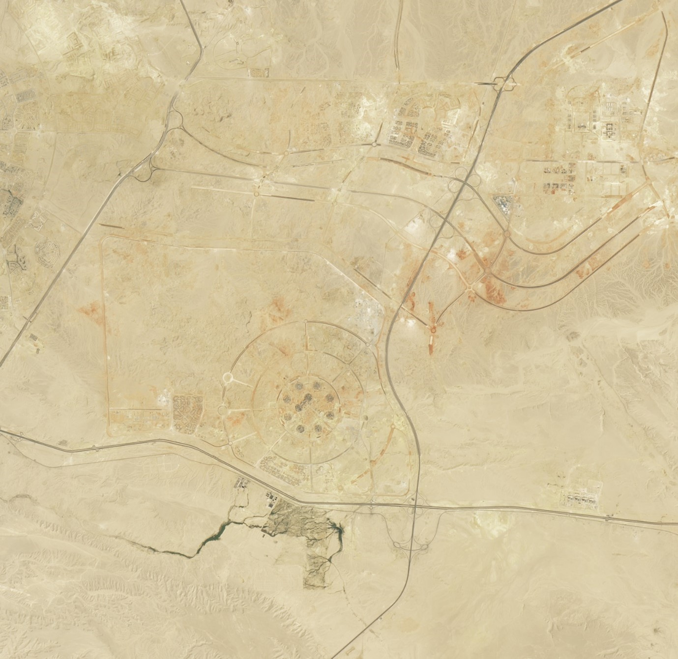
Figure 2: Area east of Cairo 2024
Images can be downloaded (including one that shows changes between 1984 and 2024) at
Constructing Egypt’s New Capital (nasa.gov)
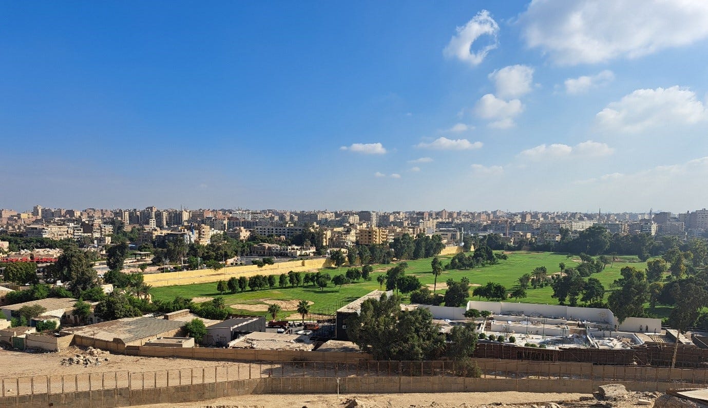
Finally, since you insist, here are two holiday snaps, 180 degrees opposite to each other. The Great Pyramid of Giza, and the view back over the city towards Cairo.
Figure 3. The Great Pyramid, Giza
(Note the man in the dark suit in the foreground - in temperatures over 35C. He is an armed security guard. There are several on the site along with more obvious troops and police – you might argue he is pretty obvious!)
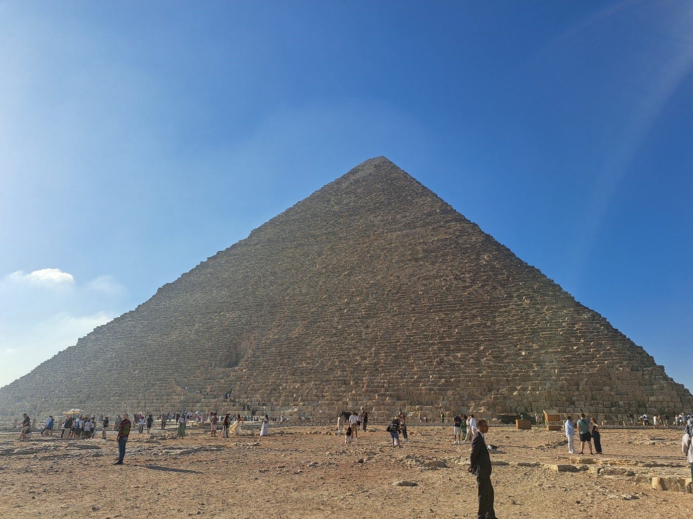
Figure 4. 180 degrees from the above. The view over Giza towards Cairo.
(Note the golf course in the foreground – you don’t get many of these in Egypt.)
Good stuff David fir the A levellers on a number of levels and topics