


Satellite stories – 8
Isostatic uplift in SW Finland’s archipelago (Kvarken - Bjorko) – coasts and glaciation

[The 3k number of subscribers has been passed - welcome, and thank you to all.]
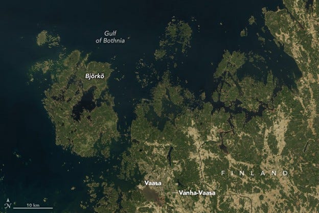
Location map

Figure 1.
During the last glacial maximum, 20,000 years ago, the Baltic Sea was under a sheet of ice as thick as 3,000 metres. Scientists estimate that the weight of that ice pressed the land down more than 500 metres. Since the glaciers receded and the weight was lifted, the land has been bouncing back. The rates of uplift, known as isostatic readjustment or isostatic rebound, in this region are among the highest in the world. According to one estimate, 700 hectares of new land rise from the sea each year along the coast of the Gulf of Bothnia, the Baltic Sea’s northern arm.
This uplift is especially apparent in the South-west (Kvarken) Archipelago of Finland. The area, seen in the satellite image Figure 1 is an agglomeration of islands that is constantly changing as the land rises. Its approximately 5,600 islands and 2,400km of shoreline form labyrinthine waterways that present hazards to shipping but opportunities for exploration for canoers and kayakers. The Kvarken Archipelago is designated as a UNESCO World Heritage site.
The terrain emerging from the sea has revealed several glacial formations. On and around the island of Björkö, shown in Figure 2, unique features known as De Geer moraines have surfaced due to isostatic rebound. These ridges form when water running beneath the ice deposits boulders, stones, and finer material at the ice edge. When the ice retreats or a large block breaks away, another moraine begins to form at the new edge.
Figure 2. More detailed map
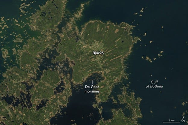
De Geer moraines typically measure 1 to 2km in length and 2 to 5m high, spaced 50 to 200m apart. Scientists believe the moraine’s presence and spacing are related to the speed of ice-margin retreat, the water depth in which they were formed, and the terrain beneath the ice.
The constant emergence of new land after the ice’s disappearance affected how people ultimately developed the area.
For example, the land on which the town of Vaasa (Figure 1) was founded was a forested island in the early 14th century. The island later merged with the mainland, and Vaasa grew throughout the 17th and 18th centuries as a thriving harbour and trading point. However, the land continued to rise, causing the coastline to migrate farther and farther from the town. In August 1852, a peddler’s pipe ignited a fire that destroyed much of the settlement. Officials took the opportunity to reestablish Vaasa about 6 km to the west to make it a coastal city once again. Remnants of the original town are preserved in ‘Old Vaasa’ (or Vanha-Vaasa) [Figure 1].
Figure 3 Aerial photograph
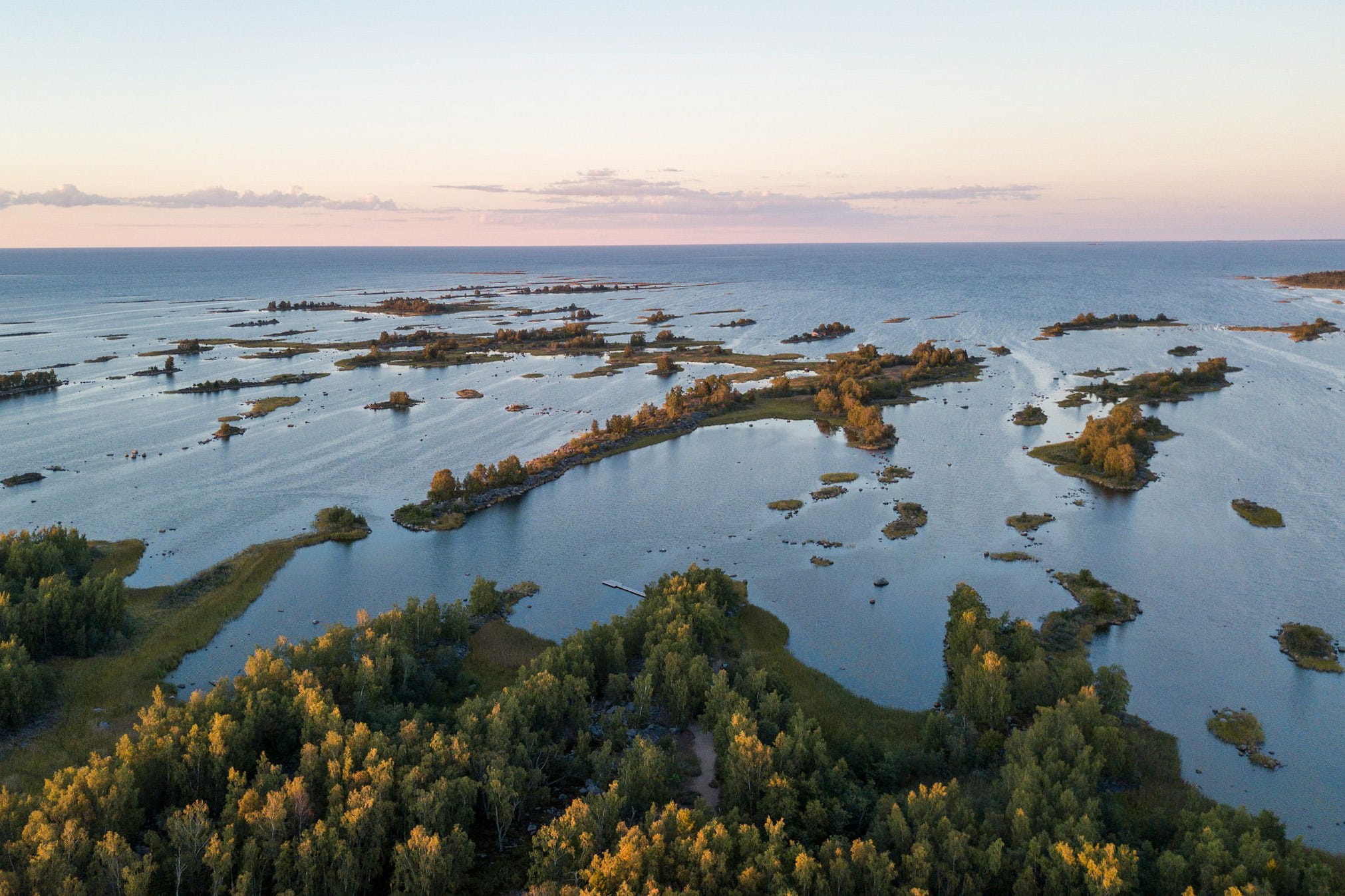
August 2020
The islands, peninsulas, and coastlines around the Kvarken Archipelago and the Gulf of Bothnia will continue to develop and modify. Since the ice retreated, the land has risen at least 286m. Over the coming years, sea level here will continue to drop relative to the land, and the Gulf of Bothnia will continue to narrow. Millennia from now, the shores of Finland and Sweden may even connect at the narrowest point, rendering the northern Gulf of Bothnia an inland lake.
However, the exact nature of these changes will depend on how much global sea level rise, driven by ice cap melt and thermal expansion of ocean water, offsets the regional uplift of the land. Currently, the rate of regional uplift, at about 9mm per year, is larger than the 3.5mm of global sea level rise per year.